Day 13: Blanding to Moab via Canyonlands National Park - The Needles district
Heading down Utah state route 211 toward Canyonlands, we made a quick stop at Newspaper Rock State Historic Monument; the oldest petroglyphs here date back about 2000 years.
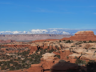
Then it was on to the remote Needles district of Canyonlands National Park, where we stopped first at the Visitor Center to inquire about acrophobe-friendly trails. We ended up hiking the
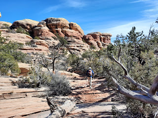
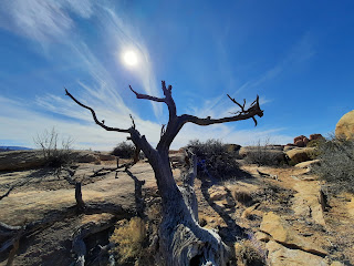
Chesler Park Loop Trail, which had enough height challenges to generate some thrills but no real terror moments. This ~11.25-mile loop was one of the most enjoyable hikes of our entire trip.
 |
| No cellphone service, so the National Park provides payphones. |
 |
| Where the acrophobe said "you want me to go down that?" |
Day 14: Arches National Park
When I lived in Tucson and temps soared into the 100s, everyone said "yes, but it's a dry heat"--meaning ~115oF feels like a mere ~102oF. Utah has taught us that there's also a dry cold. It can be 30 or 40oF, but if the sun is out and you're hiking, you'll end up taking off your coat. If it rains, though, cold is cold.
Consequently, the day we spent at Arches National Park--a day forecast to have a 15% chance of rain--ranged between dry-cold warm and wet-cold cold.
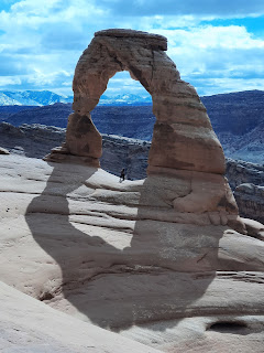
We did three hikes. First, the iconic Delicate Arch. We ran into several other acrophobes on the trail, recognizable because we all clung to the sides of the cliffs and encouraged other hikers to pass us. The trail was wide and generally tilted toward the cliffs rather than downward toward certain death, so it was quite manageable.
 |
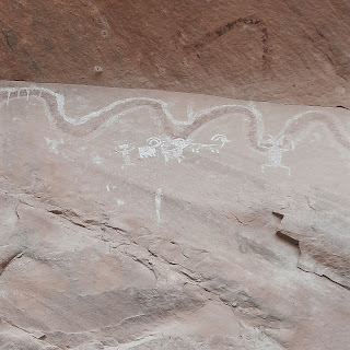
| Petroglyphs along a short detour |
 |
I might start collecting photos that channel
Andrew Wyeth's Christina's World... |
 |
| Delicate Arch is just around this bend... |
 |
| People lined up to take photos |
 |
| Twisted Donut Arch, en route back from Delicate Arch |
 |
| View from the hike back down the slickrock |
Second hike was a
three-arch loop from Sand Dune Arch to Tapestry Arch to Broken Arch.
 |
| Sand Dune Arch |
 |
| Tapestry Arch |
 |
Continuing to channel Caspar David Friedrich's
Der Wanderer über dem Nebelmeer--this time at least with clouds. |
 |
| Rain/snow |
 |
| Broken Arch |
 |
What German's call Graupel--not quite snow,
not quite hail. It accumulated quickly! |
Our third hike began at the
Devil's Garden trailhead; we walked far enough to see Tunnel Arch, Pine Tree Arch, and Landscape Arch. Landscape Arch is the park's widest spanning arch, at ~290 feet.
 |
| Tunnel Arch |
 |
| Pine Tree Arch |
 |
| Landscape Arch |
 |
| Fins--yet another of Utah's abundant geological features |